
ARMENIAN GENOCIDE MUSEUM
|
|
|
|
|
|
|
|
|
|
|
|
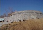
The Museum of the Armenian Genocide opened in 1995 in time to commemorate the eightieth anniversary of the Genocide. The Museum structure is of unique and original design. (architects: S. Kalashian and L. Mkrtchian). This two-story building is located at and in the side of a hill so as not to detract from the imposing presence of the Genocide Monument nearby. The roof of the building is flat and covered by concrete tiles. It serves as a scenic view point overlooking the Ararat valley and Mount Ararat.
The first floor of the Museum is below grade and houses administrative, engineering and technical maintenance offices and spaces, a 170-seat hall (Komitas Hall), storage rooms for museum and scientific objects, a library and a reading hall. The Museum exhibit is mounted in the second floor in a space which is over 1000 square meters. It occupies three indoor halls and one outdoor hall and its hallway. An eight meters long and three meters wide basalt stone lies on the floor of the outdoor hall and the hallway. The outdoor hall symbolizes the eternal memory of the victims of the 1915 Genocide and the unity of the Armenian people spread throughout the world. It also expresses the struggle between good and evil, light and darkness.
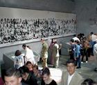
The western wall of the Museum's first exhibit hall has a map engraved in stone which shows the historical Armenian Plateau and neighboring countries. It is bounded by the Black Sea in the north, the Caspian Sea in the east, the Iranian Plateau in the south, and the Mediterranean Sea to the southwest. The map shows the Armenian settlements on the territory of Western Armenia and Ottoman Turkey which existed until the massacres of the Armenians and the massive death marches which began in 1915. The map is nine meters wide and five meters high.
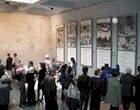
The Introductory Hall exhibits photographs and ethnographic tables with information about the Armenian settlements and Armenian population figures in 1914 in Ottoman Turkey. They also contain information on the number of Armenian churches and schools which were functioning in the region at that time. A composite of the tables there and in the third hall provide a visitor with the following data, including the population figures in 1914 before the Genocide (See the following charts).
|
Name of Armenian Region and settlement (1914) |
Number of Armenian settlements (1914) |
Number of Armenian Churches (1914) |
Number of Armenian Schools (1914) |
1914 Population |
|
Erzerum |
425 |
482 |
322 |
215,000 |
|
Van |
450 |
537 |
192 |
197,000 |
|
Diarbekir |
249 |
158 |
122 |
124,000 |
|
Kharput |
279 |
307 |
204 |
204,000 |
|
Bitlis |
618 |
671 |
207 |
220,000 |
|
Sivas |
241 |
219 |
204 |
225,000 |
|
Trebizond |
118 |
109 |
190 |
73,390 |
|
Western Anatolia |
237 |
281 |
300 |
371,800 |
|
Cilicia & Northern Syria |
187 |
537 |
176 |
309,000 |
|
European Turkey |
58 |
67 |
79 |
194,000 |
|
TOTAL |
2,925 |
3,368 |
1,996 |
2,133,190 |
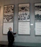
The second exhibit hall (700 square meters) presents eyewitness reports and documents about the massacres and atrocities perpetrated against the Armenians. The exhibit has many large photographs taken during 1915-1917, archival documents, portraits of prominent Armenians, victims of the atrocities, friends of the Armenian people, and documentary films.
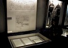
A special part of the exhibit is reserved for the original documents issued by international organizations and parliaments of foreign countries condemning the Genocide.
Numerous different publications about the Armenian genocide written in many languages are also exhibited.
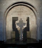
This hall also shows tables with data on the number of Armenians living in different countries of Europe, Asia, Africa, America and Australia after the Genocide. In the same hall a granite pedestal supports crystal vases which hold earth from historic Armenian regions: Erzerum, Van, Baghesh (Bitlis), Sebastia (Sivas), Kharpert, and Tigranakert (Diarbekir). It also holds the skull and bones of a young Armenian killed in the Der Zor desert. In the same hall, a granite tree with spreading branches symbolizes the eternity and rebirth of the Armenian people.
The tables displayed in the third hall show the Armenian population figures in 1914 and 1922 (See chart below).
|
Name of the Region |
Population in 1914 |
Deported or Killed |
Population in 1922 |
|
Erzerum |
215,000 |
213,500 |
1,500 |
|
Van |
197,000 |
196,000 |
500 |
|
Diarbekir |
124,000 |
121,000 |
3,000 |
|
Kharput |
204,000 |
169,000 |
35,000 |
|
Bitlis |
220,000 |
164,000 |
56,000 |
|
Sivas |
225,000 |
208,200 |
16,800 |
|
Trebizond |
73,390 |
58,390 |
5,000 |
|
Western Anatolia |
371,800 |
344,800 |
27,000 |
|
Cilicia & Northern Syria |
309,000 |
239,000 |
70,000 |
|
European Turkey |
194,000 |
31,000 |
163,000 |
|
TOTAL |
2,133,190 |
1,745,390 |
387,800 |
The last hall of the Museum is essentially an outdoor patio, a traditional feature in old Armenian structures. A semicircular basalt wall is divided into twelve equal segments. Each of the segments contains a sentence condemning the Armenian Genocide by prominent foreign politicians, diplomats, scientists, and writers of that period. The hall looks like a courtroom where eyewitnesses present their condemning evidence. The last word belongs to the visitor, who can make a judgement based on the materials presented.